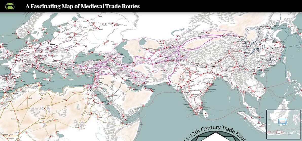
I am looking for a blank outline map of Silk Road routes from the Pacific to Europe including African and European cities and outposts. Ideally the route(s) will be pre-drawn. Students label cities/outposts. Current sources insufficient.
-
1This seems very specific. Have you considered making your own? It would probably be much less work than scouring the internet for the perfect rendition for your purposes.– T.E.D. ♦Commented Oct 1, 2019 at 16:26
-
2Consider taking a labeled map and removing the labels in your favorite image editor?– AllInOneCommented Oct 1, 2019 at 16:32
-
Here is an ArcGIS online layer with the data you want. You can turn various layers on and off and change the basemap if you want. arcgis.com/home/webmap/…– ed.hankCommented Oct 1, 2019 at 17:18
Add a comment
|
1 Answer
Maybe this image might be interesting:
https://www.visualcapitalist.com/medieval-trade-route-map/
It represents XI and XII centuries, and covers most of Asia, Africa and Europe. The map includes a list of sources that you might try to follow.
From the comment below:
