There's a lot in the question that seems to be assuming modern knowledge that Columbus most likely did not possess.
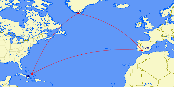
There is no good evidence the Iberian maritime community in the late 15th century had any knowledge of Greenland. The European settlement there did not exist by the time the printing press was invented, so any knowledge of it (unlike Portugal's and Columbus' discoveries) would have had to be hand-copied. The Danes knew about it, but they also laid claim to it, and this was an era where kingdoms jealously guarded maritime information as state secrets. So what knowledge was known would not have been as complete as what the Danes had access to, and no Iberian nation could lay claim to any route found using it.
Remember, Columbus was not trying to "explore" or find the Americas, or anything like that. He was trying to get to the (East) Indies. Spain and Portugal already had possession of convenient sets of islands in the Atlantic (the Canaries and the Azores respectively) which would be great staging points for getting there.
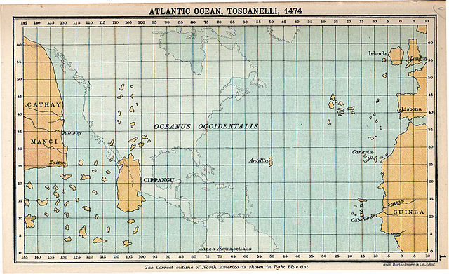
Wikipedia has a very convenient map showing Toscanelli's 1474 map superimposed on the actual globe projection. Columbus was sort of a disciple of his and used this map and others like it for his conception of world geography.

You can see that not only did it have no concept of Greenland, but where it actually exists would be much further from where he thought the Indies were than the Canaries. Not only that, but Columbus thought the Indies were even closer than this map shows*. To be exact, he thought the Canaries were only 3,700 km from the Indies (rather than 20,000!).
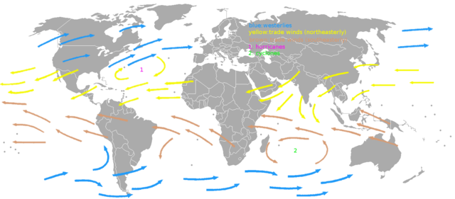
What he did have was a correct conception of the trade winds in the Atlantic. These blow in roughly a clockwise direction in the northern hemisphere. What this means is that if you try to sail from the Canaries straight west, the winds will be helping you. However, if you try to sail from Greenland southwest, you'd be going straight into the wind. So even if it were an otherwise good route that someone knew about, sailing that direction from Greenland would not be an efficient way to cross the Atlantic.

* - He underestimated the distance between those longitude lines


