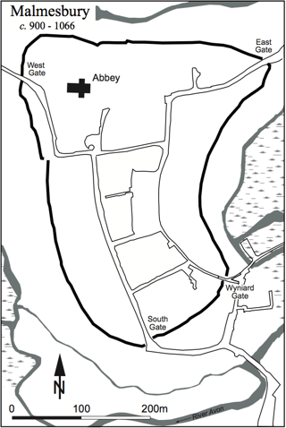
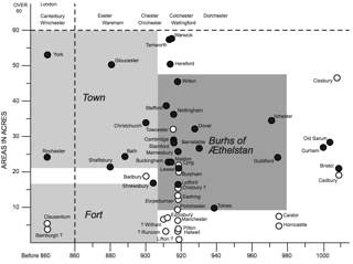
The burhs were made in a variety of different ways, depending on materials available locally, and the size of the settlement or area it was intended to defend.
Frequently, a burh was built on the site of pre-existing fortifications. Sometimes, the Anglo-Saxons would simply repair old Roman walls in towns such as Winchester, Exeter, York, Burgh Castle, Portchester and Dover. At other times, they would build on the site of old Iron Age forts, such as Dover, utilising the old ditches and ramparts.
However, the Anglo-Saxons did not just use old fortifications. Many of the burhs built by the Saxons were entirely new fortified sites, built on strategic sites on the coast, near ports or overlooking roads and trade routes. Substantial new towns were built on flat land with a rectangular layout, at for example Oxford, Wallingford, Cricklade and Wareham.
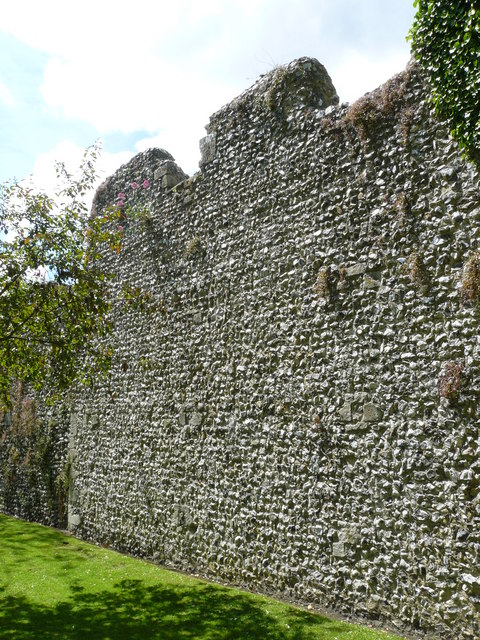
Traditionally, burhs were constructed first with a massive series of banks fronted by a ditch. The bank was typically timber faced and timber revetted. This was topped by a wooden palisade of stakes, up to 10 feet (3.0 m) high, with a walkway. At towns such as Tamworth, the ramparts would decay and push outwards over time, meaning that the ditch and bank would deteriorate. To solve this, Anglo-Saxon builders faced banks with stone, thus further reinforcing the defences and improving their life span.
"The walled defence around a burh. Alfred's capital, Winchester. Saxon and medieval work on Roman foundations."— WP: Burh
One important note may be here that it is not solely focused on defending one point, or one front-line, like Hadrian's Wall, but defending 'in-depth', controlling strategic points to cover the land with protection.
This is not to deny the important access rivers provided to inland regions, but it was in their use as a vector of entry to the overland road network that they were most significant in a military context. Travel along rivers did not automatically permit the pillaging of estate centres—in many places, a river such as the Thames is surrounded on one or both sides by a wide natural floodplain that probably consisted in the Anglo-Saxon period of heavy marshland. Disembarkation along these stretches of river would have been treacherous, and a ship-borne force would need to find appropriate places to come ashore—for example, established landing places or fords. Movement upstream could be slow and predictable from the viewpoint of defending forces. Roads, on the other hand, cut across important estates, regularly intersect with other roads, and allow more rapid movement by forces not excessively burdened with booty or equipment.
The fact that crossings were the priority of military planners can be seen from the location of strongholds throughout Wessex and especially along the Thames. The construction of forts at both ends of the same crossing simply provided a more reliable defence of that crossing and greater control of its use. The securing of major fords was important from both defensive and offensive perspectives. On the one hand, it allowed speedy and uninhibited movement of troops across Wessex and also, for campaigning purposes, into hostile territory; on the other, it denied enemy access to the same crossings into Wessex or easy movement within the kingdom.
— John Baker and Stuart Brookes: "Beyond the Burghal Hidage Anglo-Saxon Civil Defence in the Viking Age", History of Warfare 84, Brill: Leiden, Boston, 2013.
From that book, some illustrations:
Archaeological evidence from the 1968 excavations and imaginative reconstruction drawing of the Tamworth gatehouse.
Models of warfare after Luttwak, showing A) Linear defence, B) Defence-in-Depth.
Map of beacons in Kent, by William Lambarde, “commissioned by Lord Cobham in order to have multiple copies made, as a guide to the effective use of beacons. The posi- tions of about fifty beacons are marked, with lines indicating the direction of the signals given off by them.” Originally published/produced in 1585.
20-mile radii drawn around the first-phase burhs of the Burghal Hidage.


