5

In other words, which Renaissance cartographer was the first to really enrich their maps with imagery or icons that indicated other attributes about the locations they were mapping, or the people who lived in those locations?

To help this question lend itself to a specific answer, I've updated the question to narrow the focus to the Renaissance, and I'll suggest that the "additional context" provided by the cartographer be anything beyond the physical data points such as spatial coordinates, borders, terrain, & location names.

7
  • Indeed! Those first ones were highly artistic in nature. But I guess I'm gearing my question more towards those (possibly entering the Renaissance) that were based on the best available data points, but began to layer additional context on top. Commented Dec 8, 2017 at 14:50
  • @Semaphore I think that's a good starting point. In my prior comment, I mention the Renaissance, where it seems like they really hit the gas on adding that additional context. I'm wondering if there is an individual who was really the paragon of that notion. Commented Dec 8, 2017 at 14:58
  • The problem is this is getting into an opinion-based and list forming question. Can you check out the tour and How to Ask areas perhaps and fine-tune your question? There would be too many opinions to have a single, correct answer.
    – justCal
    Commented Dec 8, 2017 at 15:07
  • Yes @Semaphore. Among other things, the lack of reliable information would have made old maps more prone to this "I do not have info about the region, but tales from the travelers tell of scythes in the zone, so I will just write 'Scythes' to give some info but I cannot draw any feature".
    – SJuan76
    Commented Dec 8, 2017 at 15:12
  • @justCal Yeah, I struggled with that a bit as well. I'll try to re-phrase the question to lend itself to more of a definitive answer. Commented Dec 8, 2017 at 15:13

2 Answers 2

6

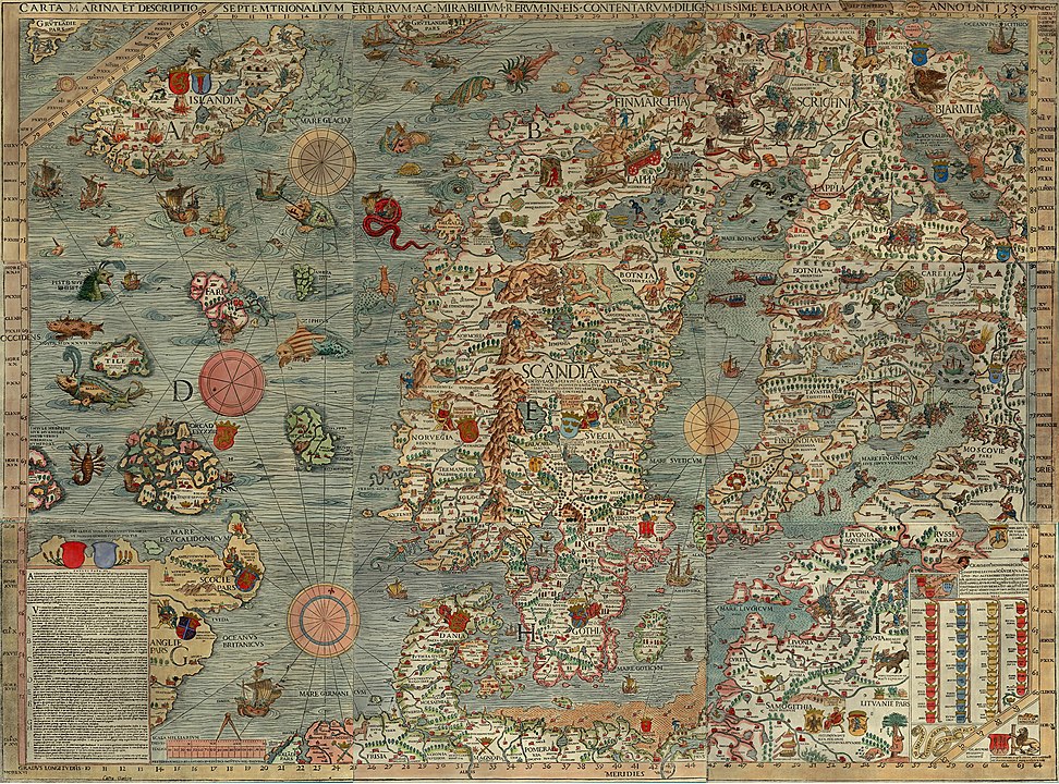
(Update) Recently I encountered some single edition maps, and one map and cartographer in particular that seems to better exemplify your question. The cartographer would be Olaus Magnus, and his map the Carta Marina, first published in 1539. (A higher resolution image here)
enter image description here

The entire map is covered in 'rich content' and imagery concerning behaviors of the peoples living in these northern regions. Scenes such as ice-fishing, skiing and reindeer riding are mixed in with elements of myth and legend.

So much information is included on this map that Magnus wrote an accompanying text explaining many of these scenes or vignettes; The Historia, or fully Historia de Gentibus Septentrionalibus, “A Treatise concerning the Northern Peoples.” Though the originals were in Latin and Italian I believe, kimchi lover found a link to an English translation which can be downloaded here. This version unfortunately lacks the vignette drawings which can be seen in the Latin version viewable here. Elements depicted on this map are repeated in later maps such as the Abrahan Ortelius atlas the 1570 Theatrum orbis terrarum and images are repeated in some of Conrad Gessners' early zoological volumes such as the Historia Animalia (Library of Congress versions here)


A later individual whose work also covers aspects of what you are looking for would be Georg Braun.

From 1572 to 1617 he edited the Civitates orbis terrarum, which contains 546 prospects, bird's-eye views and maps of cities from all around the world
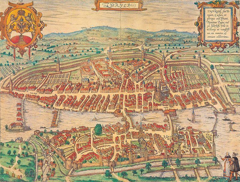
enter image description here (above map or Zurich from same article)

Though Munster was actually an inspiration of Brauns, I belive the rich detailing of the city maps that Braun did really stands out. The extra details he included that represent the 'rich content' you are asking about included:

  • any crest or emblem (coat of arms) that represented the city
  • the maps were often drawn in a perspective that lent to a view of the surrounding countryside
  • a representation of local inhabitants, in traditional (or stereotypical) costume for the time
  • and in many cases, a list of important locations within the city in table form(not visible on this image, but if you look at images of Rome or Venice,for instance, you will find examples of the tables)
  • the details on the drawing of the buildings, such as the mills on the river, the barns in the farms, ect. You can spend hours going over these images just looking at the minute detail.

Map of Brussels below showing the aforementioned tables of city locations.
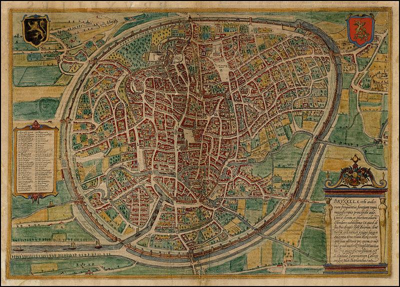
enter image description here

2

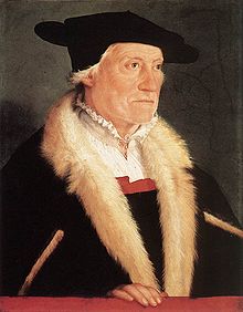
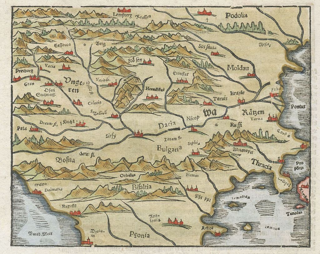
The Swiss Sebastian Münster One of the most important cartographers of the Renaissance. His Geographia, published in 1540, became the new global standard for maps of the world.

enter image description here

enter image description here

enter image description here

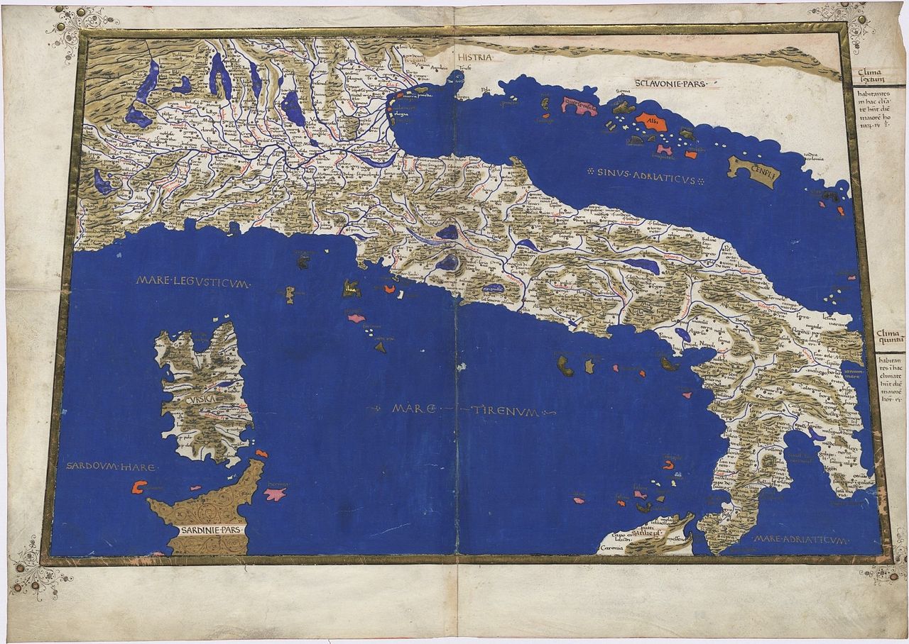
The "Geographia universalis" first printed in 1540 was one of the most reliable editions of Ptolemy. Münster used a Greek manuscript for his translation and corrected many misinterpretations of the earlier Latin text by Willibald Pirckheimer with corrections of 1535 by Servetus. Along with the traditional 1+26 Ptolemaic maps the book included 21 modern maps. The new maps marked the development of regional cartography in Central Europe. All the maps were printed from wood blocks, made by the Basler artist Conrad Schnitt. The geographical names and map inscriptions were printed from stereotypes and/or from set metal types in the case of titles outside the upper border, and the descriptive text found in panels on the verso side of the maps. It was Münster, who devoted a map for each continent in his book and this invention was followed later by Ortelius and the modern atlas publishers. The map devoted to America is one of the most famous and important of the sixteenth century. When one considers that Munster was working only some 50 years or so after Columbus discovered the America, the fact that there is any realistic substance to some of the maps is quite amazing. The woodcut borders surrounding the type on the verso of the maps are largely the work of Hans Holbein. The Geographia was a very successful product: two year after the first edition it was reprinted in 1542, than again in 1545 and 1552.

Your Answer

By clicking “Post Your Answer”, you agree to our terms of service and acknowledge you have read our privacy policy.

Not the answer you're looking for? Browse other questions tagged or ask your own question.